Thursday, July 10, 2014

My new ride: TU250X

I just bought a TU250X last month. Here it is:

It is a small bike, but has a closed loop injection system, which means I won't run in the gummed carburetor problem I have on my GS500E. Plus it is light enough to do some mild off roading, or dual sporting, as it is now called. Since this is a street bike, I started with an easy ride: Spada lake, and I had a blast. I do not regret my choice of a light bike, off-road is where I can appreciate the simplicity of the TUX.

Seattle to Monroe, via back roads (Novelty Hills, NE Snoqualmie rd) ~ 35 miles.
Monroe to Spada Lake = 27miles, including 8miles of switch backs on gravel.


From Monroe WA, take Old Owens instead of the boring Highway 2. It will lead you to Sultan through a 35mph (legal limit) road. The TuX is in its ideal element on such roads.
Enter Sultan, take Highway 2 to cross town, then turn left on Sultan Bassin road at the last traffic light. This is another 35/25mph road, starting with a long hilly stretch, followed by multiple turns, the guys that drew those turns must has had the TuX in mind... Uphill, the engine nicely speaks as you progressively open the throttle.
The gravel road goes up to 2000FT in a series of switch backs, most of them taken in 2nd gear. There are a few flat stretches where I could go up to 4rth and allow the engine to cool of. The climb and the thinner air are going to put some thermal stress in the engine, so don't hammer it too hard. I kept rpms low, sometimes very low, just to reduce the amount of torque on the rear wheel and avoid skidding on the gravel. Everything went fine, and the engine sounds is pretty nice at low rpm.
At the top of the road, you have to register. There was a truck registering when I stop, one of the passengers came to me and said "nice bike, what year is it?". He was surprised to hear "2009". This is the second time I get a compliment on the bike, the first time was the day I bought it, 3 weeks ago. Leaving the registration area, I took the right path, the South Fork, which is the longest. The left path goes to Culmback dam, but it is a short drive, followed by a hike. The path on the right goes to two boat launches and nice picnic areas. Here is a pic at the first stop.

There are a few very nice picnic areas at that first stop. You can also fish. Here is a view of the lake, with snow covered tops in the background.

The gravel road goes further, with some nice views of the lake, and ends to a second rest stop / boat launch:

The lake is actually a fresh water reservoir that provides most of Snohomish county water. No swimming, nothing that involves body contact with the water, and no power boats allowed. I drink that water every day, so be kind :-)
View from the second boat launch, looking North. Only light row boats and electric boats allowed.

Same spot, looking South.

Time to leave. Last snapshot, looking at the mountains. The lake was in my back.

The drive back was fun, after the gravel switch backs, the Sultan Basin road is a dream on the TuX. Next time I may check Culmback dam.

One thing I found out is that the front fork springs are too soft for dual sporting, they compressed hard on the potholes. I was advised to replace them with stronger springs by a motorcycle mechanic I met on my morning commute. I think it is a good advise I will probably follow.

Warning: the road is snow covered for a good part of the year, and access to the lake is blocked by a barrier. Check on the snopud website for accessibility to the lake. It is open at this time of the year.
Saturday, August 11, 2012

Sexton Loop: Technical Ride!

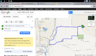
Another bicycle ride today, more difficult that last week, lots of hills, two of them I walked. I thought I would walk more, so that's not too bad. This ride was hard on me, that is good, the ride last week was a piece of cake. This is about 9 miles (last week was 15 miles), but it takes about the same time to complete.

First Ride in 3.5 Years

Last Saturday (August 4th) I took the bike for a ride on the Centennial Trail. It has being three and a half year since my last ride, and I was worried about my condition. I did 15.5 miles in an hour, surprisingly well. Here is my ride:
I am planning to do more rides to get back in shape. Maybe some day I can ride to work. That is a hilly 18 miles ride.

Thursday, May 28, 2009

Index-Galena road update

After doing some research, I found that the damage on Index-Galena road happened in November 11th, 2006.

[ Snohomish County Public Works ]
[ Washington Trails Association ]
[ flickr ]
[ NorthWest Hikers ]
[ ADVrider ]

It looks like I will have to walked a lot if I want to ride pass the washouts (there are 2 washouts apparently).

Gold Bar - Index - Galena - Jack Pass - Skykomish - Gold Bar would make a nice day trip (~72 miles).

Monday, May 25, 2009

Galena trip

Today I left home at 8:30 planning on going to Galena, through Reiter road and Index. The road to Galena is gorgeous, but hilly (ups and downs).

I was stopped a few miles from Galena, because of road damage. The road was blocked, and someone wrote "Road closed 4-ever?".

I walked passed the gate to check out what was going on with the road:

The river is actually coming from where the road was. It looks like the river decided to use the road as its bed. I wonder what happened upstream. The river leaves the road to what looks like a forest floor, not an old river bed.

I saw a lot of cabins along the Skykomish river. I wonder how many owners lost access to their cabin.
In the following picture, this is not a trail, it is a dried river bed that ends up on the road. More damage to come next winter.

I left the gate at 10:00, and arrived home at 11:40. Another nice ride. 33 miles.

Monday, May 18, 2009

Next Road trip (Gold Bar - Galena)

Last weekend, I drove through the Gold Bar - Index road, the road described in the previous post. The road has been partially repaired, the section that washed down was rebuilt, but there are still a lot of potholes, and there is a ~ 200ft stretch that is graveled. Still, I can now ride it again.
So that opens the Index-Galena road. Here is a map of that trip. Note that the Gold Bar - Index road still appears incomplete in the map, which is why the itinerary uses a section of Highway 2.


Google says it is 19.5miles, so that a 40 mile round trip. I can't wait to try it!
Galena is at about 1000FT, Gold Bar 160FT.

Tuesday, May 12, 2009

Ballad to the Edelwess Cafe (road bike trip)

This is a road trip I used to make in 2007, before the road washed away during winter storms. This road goes from my house in Gold Bar, to Index. It is a gateway to the galena road and Skykomish upper valley, which I hope to tour once this road is repaired.
Starting point:

May Creek Road:

Mansion on May Creek road (foreclosed in 2008):

Ranch on May Creek road:

Reiter Pit:

Reiter Road:

Creek on Reiter Rd:

Climbing Reiter Rd:

Climbing more:

Top of the World (almost):

Beginning the descent toward Index:

Railroad crossing:

Arrival at Index:

Little cottage in Index:

Little bridge toward Emily's Park:

Read the picture...:

The picturesque Sky river:

Want a retirement home?:

Mt Index cafe and lounge (the Edelwess Cafe):

Read the picture ... :

Surrounding Mountains:

On the way back, Index Doolitle Park:

Reiter pit behind the trees (see the dust raised by the 4X4?):